It’s about time to kick off the annual Hurricane thread … we actually have something to keep an eye on:
For the North Atlantic…Caribbean Sea and the Gulf of America:
Eastern Tropical Atlantic:
A broad area of low pressure, associated with a tropical wave, is
located near the southern Cabo Verde Islands. The low continues to
produce a limited and disorganized area of showers and thunderstorms
while it moves west-northwestward at 10 to 15 mph. Significant
development of this system is not expected before environmental
conditions become even less favorable for development over the
weekend. Regardless of development, this system will likely produce
some gusty winds and locally heavy rain over the southern Cabo Verde
Islands over the next several hours.
Formation chance through 48 hours…low…10 percent.
Formation chance through 7 days…low…10 percent.
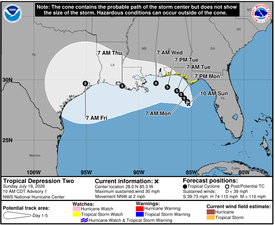
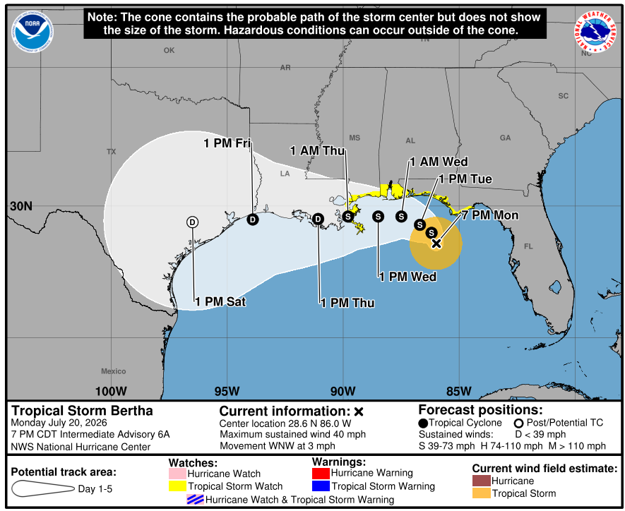
Northern Gulf of America and near Florida:
A large area of showers and thunderstorms over the eastern Gulf of
America is associated with an upper-level low and a surface trough.
Some gradual development of this system is possible while it
meanders northward, bringing heavy rain to portions of the Florida
west coast during the next several days.
I think you could take that “still” off and be understood. Did the weather folks come up with magnitude info - like “hundred year storm”? Tho I think that was more 500+. Biblical
We had a smaller magnitude ice/freezing rain/cold event here in January 2007. 3 waves in 4 days. Tree branches breaking in the woods sounded like a young war. Among other things.
It was easily a decade before the folks in this area could stop reacting to a mere momentary blip in the power. And we still talk about it as if it was the only ice storm. Ever.
That kind of severe happy crap takes awhile to get past. Altho some folks in Helene’s path may never. I think of a person walking thru an ant trail. Those ants only know something catastrophic happened. They don’t know anything about a boot, much less a human. Sometimes the weather sticks a boot on us.
Having just driven through there in May, I was moved how much was still evident infrastructure wise. I cannot imagine how much the people are still feeling it.
We are in an El Nino year. This should keep those Gulf storms down. For us, the ones that form in the Gulf are the worst. I think it’s the Pacific region that will be effected more in El Nino years?
El Niño winds come out of the pacific and disrupt the weather patterns in both the Gulf and the Atlantic. You are correct, this effect will lessen the storms on the East coast. Some still possible.
Almost all of the convection is to the southwest of the storm. It almost looks like a completely different system if you are just looking at precipitation.
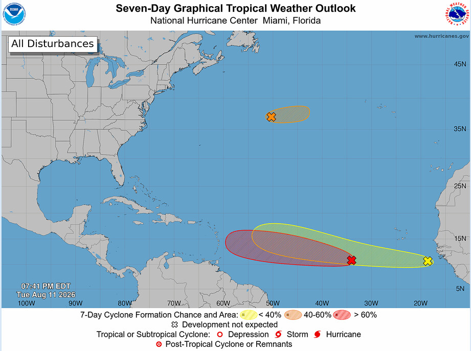
Things are getting a bit more serious in the Atlantic. The red one has 60% chance of forming a tropical depression in the next 48 hours, and 80% chance within 7 days.
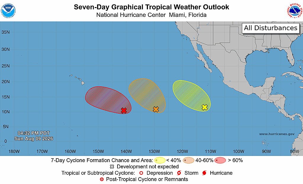
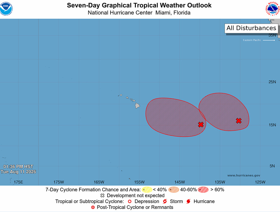
Meanwhile, the Pacific has two areas of concern. The further west one has a 90% chance of forming ini 48 hours/7 days, while the further east one has a 70% chance of forming in 48 hours/7days.

 Did the weather folks come up with magnitude info - like “hundred year storm”? Tho I think that was more 500+. Biblical
 to a mere momentary blip in the power. And we still talk about it as if it was the only ice storm. Ever.

 As long as it doesn’t turn into Big Bertha, we’re good. Time to fire up the generator.