Oh, sorry. Likely Cat 4, like 94L will “likely” become Imelda.
And stay safe from that storm coming in!
Oh, sorry. Likely Cat 4, like 94L will “likely” become Imelda.
And stay safe from that storm coming in!
I try to remind people all the time that the unnamed stuff can be just as dangerous, if not more. So while tracks and categories are important- wind directions and rainfall tracks are really the drivers to damages.
We’ve had Cat 1 and 2’s come right through with a light breeze and no rain. Everything was either to the west or the east 100 miles.
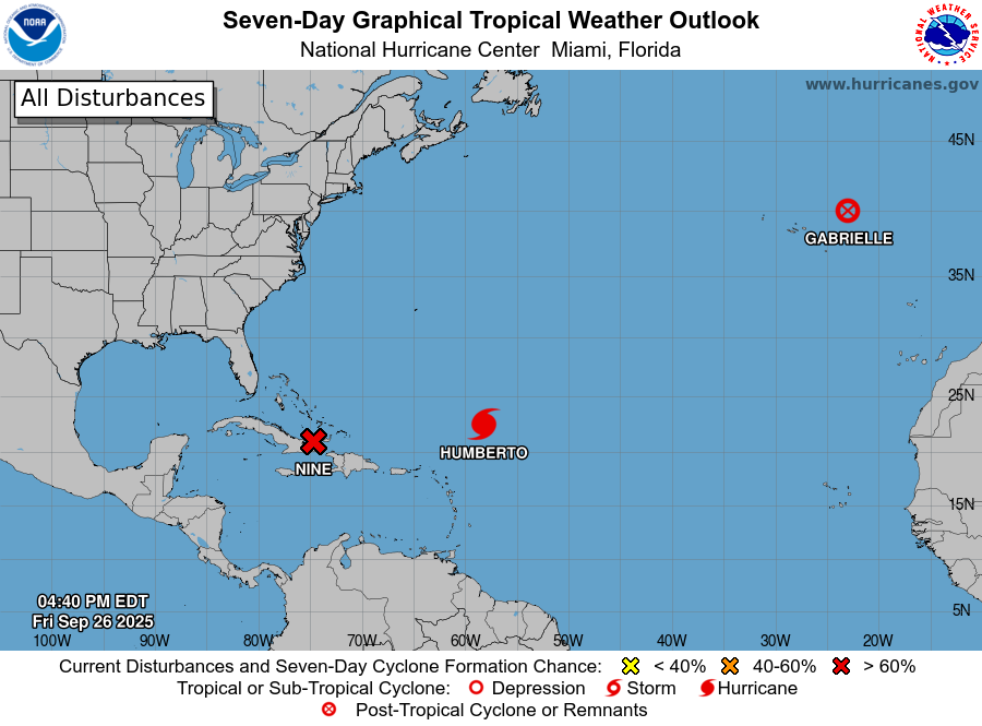
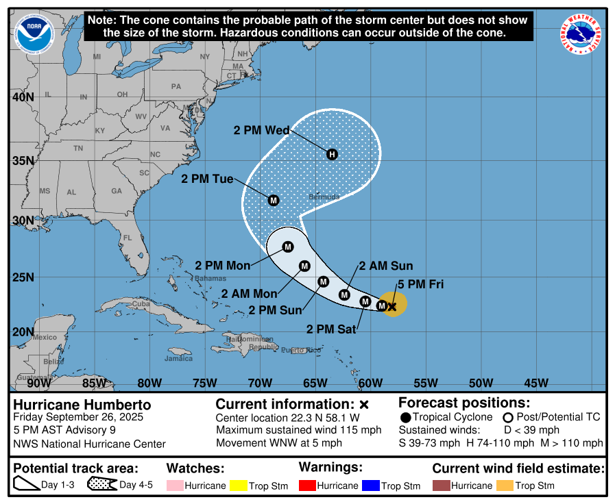
Humberto is just crawling along! They tend to increase in intensity when they creep like that.
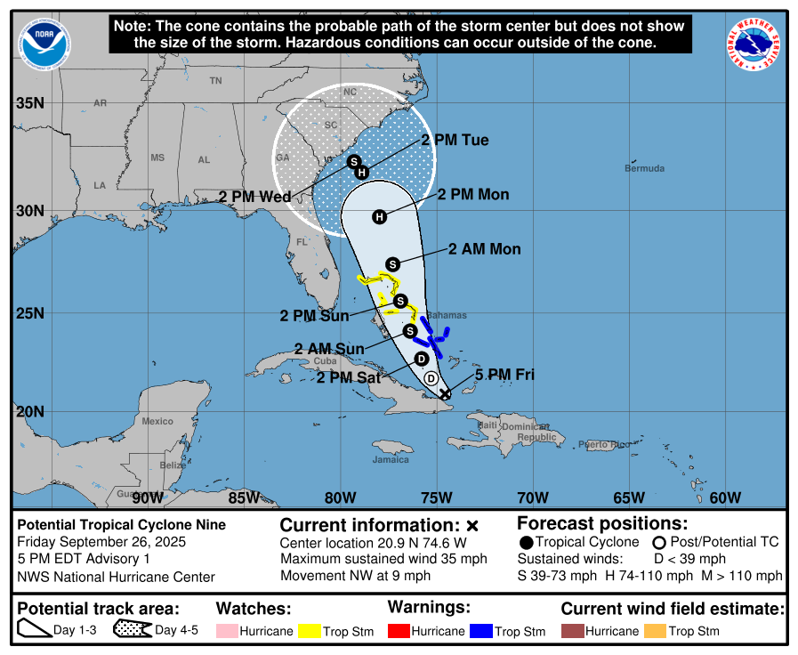
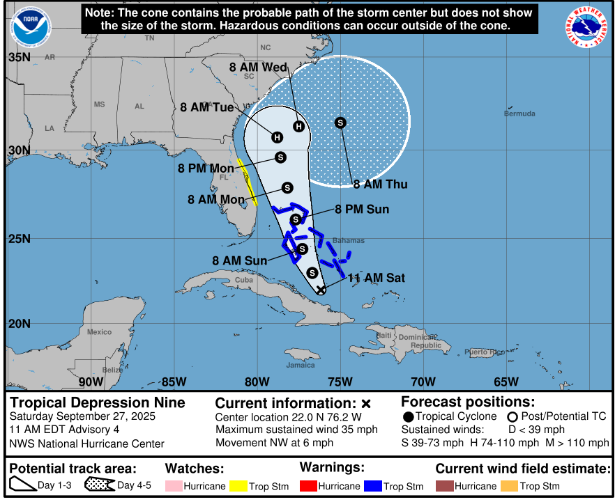
For now, it’s called Nine on their maps. That’s short for Potential Tropical Cyclone Nine. ![]()
DH just said Food Lion is running out of milk and bread.
It seems a little early for that.
Be safe @Jeff_AZ !!
My employer has reminded nurses to confirm patients have plenty of oxygen tanks and meds on hand. It’s a little LATE for that. We don’t get weekend deliveries.
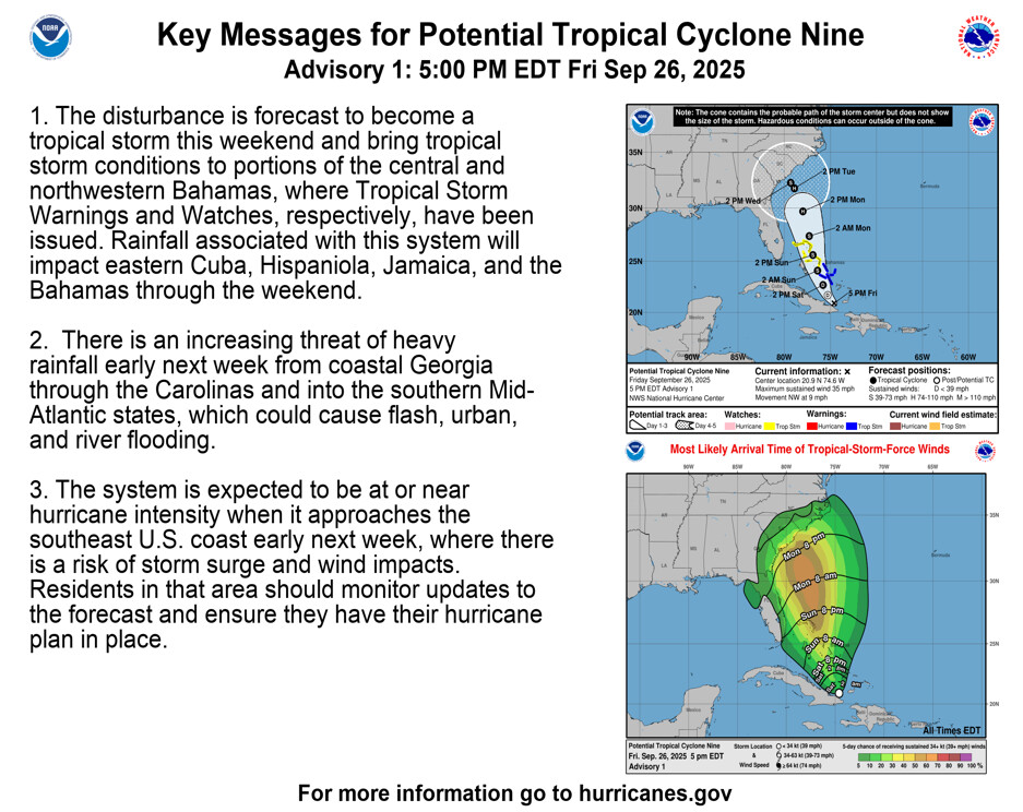
Notice that it moves like 7 miles in 24 hours from Tuesday > Wednesday. ![]()
I thought everyone only bought French Toast during imending snowstorms ![]()

Just curious if you’ve made up your mind? Seems like Florida will be safe for the weekend but hopefully it hasn’t impacted your trip. ![]()
We are still going, I just checked into my flight! I had early bird, so I already had a boarding group anyway. It could be rainy on Sunday/Monday per all the weather I’ve seen, but we will take that as it comes. Our flight home is Wednesday morning (to the mid Atlantic) so could be dicey if its still swirling around. Thinking positive!
ETA: Stay safe everyone!
Have a great time! I’m glad you’re still going on this much needed vacation!
What does that mean? Gobs and gobs of rain on the coast?
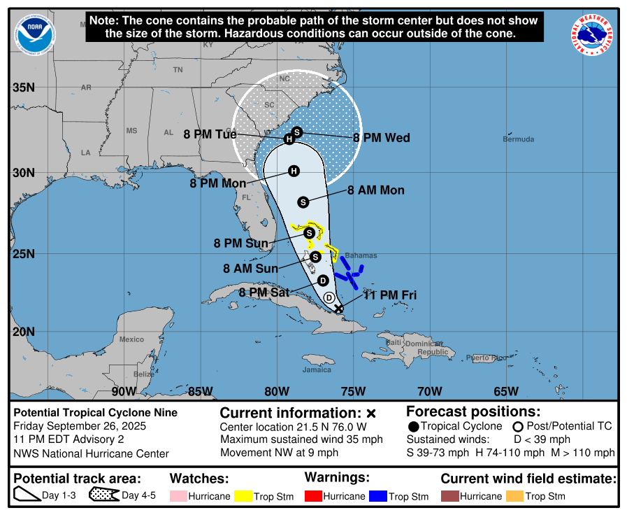
11pm update. The track has moved a little over to the east, which is always good.
Bermuda is still in the impact zone for Humberto.
Yep. Slow moving storms mean more rain. Hopefully it is far enough off shore when it comes to a rest that it is not too bad, but it will really depend on the exact track.
From WYFF >
“On Friday night, half of the tropical models started to show Imelda being pulled out to sea before making landfall, due to Humberto rapidly growing in strength.
Those trends continue Saturday morning…
The expected rain totals will drop with this current pull away from the coast. Coastal areas could see 5"+ of rain whereas the Upstate and WNC could see half an inch or less.”
Hooray! Have all the fun.
I didn’t think the storm was that close…
Looking at the track you may be looking at mid next week.
And typically the right side of the storm is the worse side. Looking at the radar it really is lop sided. That’s a good thing, especially if it skirts along the coast. Many of the smaller storms move around to minimize impact with land. They need the warmth of the ocean temps to stay together.
Keep watching it of course. Things change quickly sometimes.
Nine has officially become Tropical Depression Nine. The center looks to stay further from land as it turns to the east.